


A new study co-authored by UC Merced researchers assesses the effect of a warming climate in pushing the elevation of snow to rain higher during a storm, increasing runoff and the risk of flooding.
The study also shows the importance of spatially representative ground measurements of hydrologic variables, an effective, accurate way to forecast runoff and inform decision making. That's according to a study published in the Journal of Hydrology: Regional Studies , which uses the American River Basin in California's central Sierra Nevada, a region historically prone to flooding, as the study area.
Using hydrologic modeling and widely accepted climate-warming scenarios, and with support from the California Department of Water Resources (DWR) and Federal Bureau of Reclamation, researchers at UC Merced examined how uncertainty in the elevation of the rain-snow transition affects runoff forecasting.
"With climate models projecting a dramatic increase in extreme-precipitation events in the basin, 3.6 °F of warming could push the average transition elevation 1,000 feet higher, meaning less snow and more rain falling in higher-elevation areas," said lead study author Guotao Cui, a postdoctoral scholar with UC Merced's Sierra Nevada Research Institute. "Moreover, compared to the historical conditions, the same transition-elevation uncertainty in climate-warming conditions nearly triples its impacts on runoff-forecasting uncertainty, posing additional challenges to flood management."
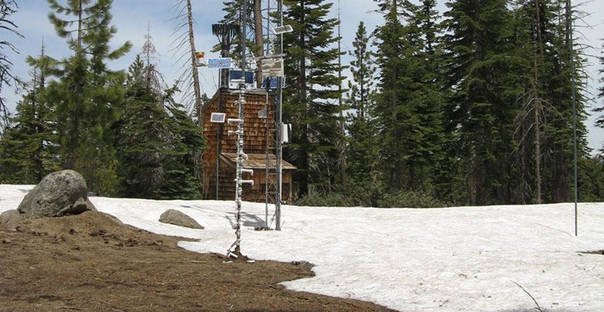
"Increasing the number of ground measurements of temperature, snow depth, relative humidity and soil moisture, and distributing the added measurement points to capture the spatial variability of the landscape, can reduce uncertainty in estimates of the rain-snow transition elevation," said UC Merced Professor Roger Bales , a co-author of the study.
"As California moves into a warmer climate, it will be important to have accurate ground measurements to predict how much precipitation falls as rain versus snow and understand how much runoff atmospheric rivers and other intense storms can generate." said co-author Michael Anderson of DWR, who also is California's State climatologist. "Future storm runoff is projected to be more intense than the historical conditions that some of our flood-management systems were built to handle, making more accurate data central to operational decision making and public safety."
This study is part of a larger program that the DWR, the Federal Bureau of Reclamation and other water providers are undertaking to better support water-resources decision making in California by moving from reliance on decades-old technology to embracing advances in sensing and computing.
"New observation technologies such as the distributed wireless-sensor networks being deployed in the Sierra Nevada, especially when combined with advances in remote sensing and hydrologic modeling, are a relatively modest investment with huge payoffs in reducing risks from extreme events," Bales said.
The findings from this study advance California's water security one step further and help address the many challenges of adapting to a warmer and more variable climate.
 Public Information Officer

