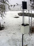
Researchers with the Sierra Nevada Research Institute (SNRI) at the University of California, Merced, have received a $2 million grant from the National Science Foundation to expand on a prototype system that uses a network of wireless sensors to track snowpack depth, water storage in soil, stream flow, and water use by vegetation in the Sierra — information that is key to efficient usage of such a scarce resource.
The research team, led by SNRI Director and UC Merced Professor Roger Bales and UC Berkeley Professor Steven Glaser, will develop and implement a network of sensors throughout the 2,000-square-mile American River Basin of the Sierra Nevada, serving as the largest prototype yet of a system that could ultimately provide water managers in California the ability to better predict snowmelt runoff, the source of much of the state’s water supply.
“With this new funding, we will be able to test our system for snow and related measurements at the full watershed scale,” Bales said. “We believe this type of wireless sensor network could ultimately revolutionize the way we understand our most important sources of water, both in California and elsewhere.”
In addition to practical applications in the area of water resource management, Bales’ system could be a boon for science in general. The data collected in the American River Basin will be made available in nearly real time through a public portal, and processed data will be provided annually, giving researchers unprecedented information about the ways in which water is collected, stored and transported within the ecosystem.
 This system is the first piece of “Intelligent Water Information for California,” an initiative of the Center for Information Technology Research in the Interest of Society (CITRIS). As one of four Governor Gray Davis Institutes for Science and Innovation, CITRIS draws on expertise from UC campuses at Merced, Berkeley, Santa Cruz and Davis and conducts world-class research relevant to California’s needs.
“The goal is to provide a real-time water supply information tool for an array of managers,” Glaser said. “Optimal usage of our scarce water supply requires that we know how much there is, where it is and where it is going.”
The research team will also conduct annual field trips to share knowledge about the system’s design and technology to other scientist, industry and government stakeholders and the general public.
“It’s very important that we’re able to share this technology and especially the information gathered with it,” Bales said. “Such a rich data set will enable the development of new modeling tools for climate assessment, better hydrologic forecasting, increased understanding of basin-scale water cycles, and improved infrastructure planning.”
The $2 million grant, awarded Sept. 16, will last for four years. The senior research team is rounded out by UC Merced Professor Martha Conklin, UC Merced research scientist Bob Rice, and Danny Marks of the U.S. Department of Agriculture’s Agricultural Research Service.


